Search Results
- IDNO:
- 001714
- Title:
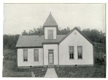
- First Consolidated School in West Virginia at Seven Pines, Marion County
- Date:
- ca. 1908
- Description:
- Schoolhouse in Marion County.
- IDNO:
- 001715
- Title:
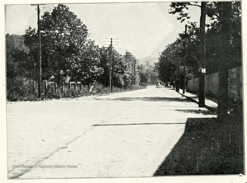
- National Road in Ohio County
- Date:
- ca. 1908
- Description:
- Cut No. 5. National road Ohio Co., where macadam has been replaced with brick paving.
- IDNO:
- 001716
- Title:
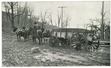
- Horse Drawn Cart on a Bad Road in Monongalia County, W. Va.
- Date:
- ca. 1908
- Description:
- Cut No. 6. A bad road in Monongalia County, West Virginia prior to organization of Good Roads Movement. Courtesy of Director Jas H. Stewart.
- IDNO:
- 001717
- Title:
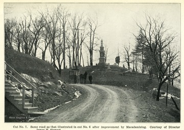
- Improvement on Road After Macadamizing
- Date:
- ca. 1908
- Description:
- Caption reads, 'Cut No. 7. Same road as that illustrated in cut No. 6 after improvement by Macadamizing. Courtesy of Director James H. Stewart.'
- IDNO:
- 001718
- Title:
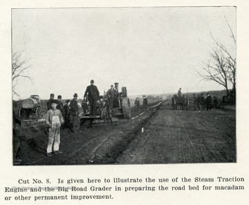
- Steam Traction Engine and the Big Road Grader Preparing the Road Bed for Macadam or Other Permanent Improvement
- Date:
- ca. 1908
- Description:
- Caption reads, 'Cut No. 8 is given here to illustrate the use of the Steam Traction Engine and the Big Road Grader in preparing the road bed for macadam or other permanent improvement.'
- IDNO:
- 001719
- Title:
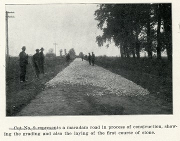
- Grading and Laying the First Course of Stone on a Macadam Road
- Date:
- ca. 1908
- Description:
- Caption reads, 'Cut No. 9 represents a macadam road in process of construction, showing the grading and also the laying of the first course of stone.'
- IDNO:
- 001720
- Title:
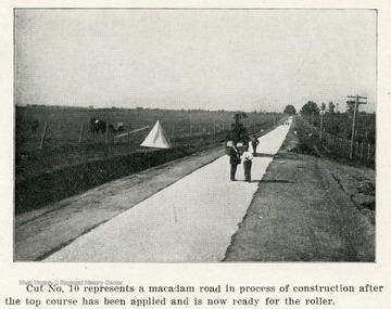
- Macadam Road after the Top Course Has Been Applied
- Date:
- ca. 1908
- Description:
- Caption reads, 'Cut No. 10 represents a macadam road in process of construction after the top course has been applied and is now ready for the roller.'
- IDNO:
- 001721
- Title:
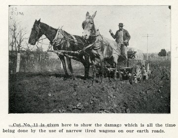
- Earth Road Damage by Narrow Tired Wagons
- Date:
- ca. 1908
- Description:
- Caption reads, 'Cut No. 11 is given here to show the damage which is all the time being done by the use of narrow tired wagons on our earth roads.'

- IDNO:
- 001722
- Title:
- Concrete Culvert under the Government Test Road near Huntington, W. Va.
- Date:
- ca. 1908
- Description:
- Caption reads, 'Cut No. 12 represents a concrete culvert passing under the Government Test Road near the city of Huntington, W.Va. This culvert has a concrete bottom, concrete wings for retaining the road and also for catching the water.'
- IDNO:
- 001723
- Title:
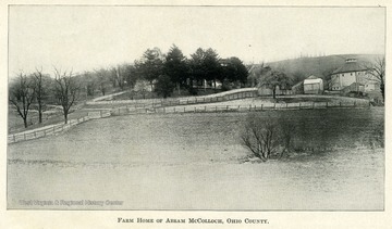
- Farm House of Abram McColloch, Ohio County
- Date:
- ca. 1907
- Description:
- A fenced in field with a barn and farm houses in the background.
- IDNO:
- 001724
- Title:
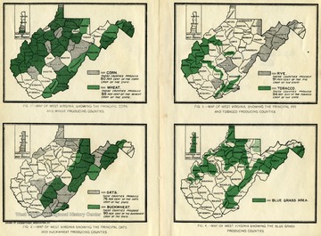
- Maps of West Virginia Showing Principle Crops
- Date:
- ca. 1907
- Description:
- Figure 1 shows the counties that produce the principle corn and wheat crops. Figure 2 shows the counties that produce the principle oat and buckwheat crops. Figure 3 shows the counties that produce the principle rye and tobacco crops. Figure 4 shows the counties that produce the principle blue grass.
- IDNO:
- 001725
- Title:
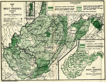
- Map of West Virginia Showing the Apple Districts
- Date:
- ca. 1907
- Description:
- This map shows the various types of apple orchards in the state of W. Va. The types range from commercially developed apple regions to homegrown apple orchards.


