Search Results
IDNO:
025260
Title:
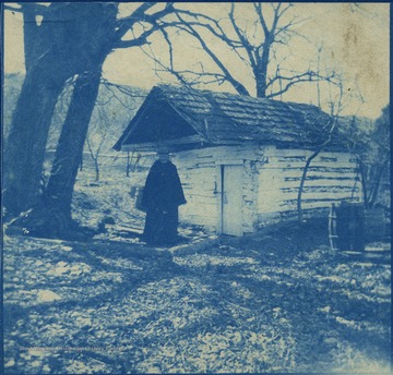
Woman in Front of Spring on John Brown's Farm, Sharpsburg, Md.
Date:
undated
Description:
Known as the Kennedy Farm, John Brown rented the homestead using the name "Issac Smith", in the summer of 1859. Located across the Potomac River from Virginia, it was here Brown finalized his plans to raid the United States Armory at Harpers Ferry. The woman in the photograph is not identified.
IDNO:
028530
Title:
House with Wrap-Around Porch, Oakland, Md.
Date:
1914/07/31
IDNO:
028902
Title:
Oakland Hotel, Oakland, Md.
Date:
ca. 1905-1925
IDNO:
028924
Title:
Bird's Eye View of Oakland, Md.
Date:
1909
IDNO:
028991
Title:
Band, Oakland, Md.
Date:
1910
IDNO:
029077
Title:
Winter Scene, Grantsville, Md.
Date:
ca. 1905-1925
IDNO:
029078
Title:
LIttle Meadows on the Ocean-To-Ocean Speedway, Near Grantsville, Md.
Date:
ca. 1905-1925
IDNO:
029079
Title:
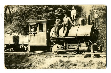
Early Steam Locomotive and Engineers
Date:
ca. 1905-1925
Description:
Engineers and others pose with a steam engine, the view is likely to be taken in Western Maryland.
IDNO:
029080
Title:
Old Meshach Browning Home as it Looks Today - Located on Sang Run, Garrett County Maryland
Date:
1919
IDNO:
029082
Title:
House Decorated for Centennial Celebration in Frostburg, Maryland
Date:
1912/08/25-1912/08/31
IDNO:
029086
Title:
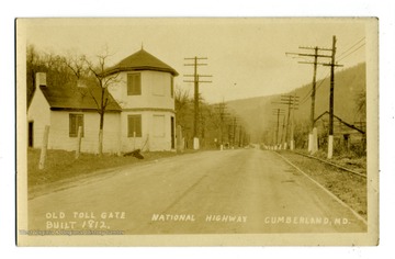
Old Toll Gate, National Highway, Cumberland, Md.
Date:
ca. 1905-1925
Description:
The old toll gate is built in 1812.
IDNO:
029087
Title:
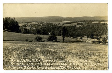
Grantsville, Md.
Date:
ca. 1905-1925
Description:
'No. 5. 1 1/2 Mi. E. of Grantsville Md. Looking W Grantsville Md & National Road up Negro Mt. district, stone bridge can be seen in valley.'
IDNO:
029092
Title:
Youngsters Walk to School through the Snow Clad HIlls of Grantsville, Md.
Date:
ca. 1905-1925
IDNO:
029123
Title:
Residence View of Washington Street, Cumberland, Md.
Date:
1907/07/28
IDNO:
029124
Title:
Street Scene in Oakland, Md.
Date:
ca. 1905-1925
IDNO:
029142
Title:
Table Rock Inn, Top of Backbone Mountain, U.S. 50
Date:
ca. 1905-1925
IDNO:
031454
Title:
Deakins Hall, Washington D. C.
Date:
c.a 1962
Description:
Deakins Hall was the ancestral home of the family which produced a Colonel of the Continental Army and the surveyor of the W. Va. and Maryland boundary line. The name J.C Wilfong, Jr. appears on the back of photo.
IDNO:
031456
Title:
View of Savage Mountain
Date:
c.a 1884
Description:
Improvement on summit of the mountain from side of Savage Mountain. Written on the back of the photo is 205.D.119.9.C.
IDNO:
031458
Title:
Conecocheque on Hagerstown and Cumberland Pike.
Date:
1884/ 08/07
Description:
Written on the back of the photo is W.(73) B 175.
IDNO:
031460
Title:
Frostburg looking Westward
Description:
Written on back of photo 204.D118.I.C.
IDNO:
031462
Title:
Civil War Battlefield - Burnside Bridge from above on the Union side
Description:
Written on the back 161 W(67)
IDNO:
031601
Title:
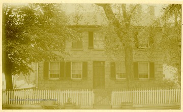
Admiral Schley Boyhood Home, Frederick, Md.
Date:
1914/10/30
IDNO:
031602
Title:
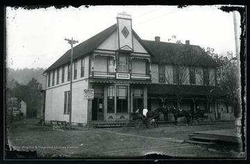
Central Hotel, Friendsville, Md.
IDNO:
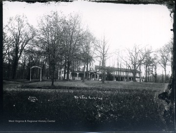
031603
Title:
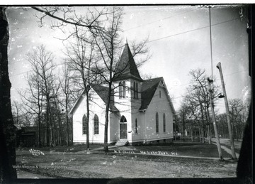
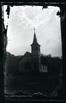
M.E. Church, Mt. Lake Park, Md.
IDNO:
031604
Title:
Church, Friendsville, Md.
IDNO:
031605
Title:
Stone Home, Howard County, Maryland
Date:
1899/04
Description:
The house is likely in Woodstock, Howard County Md.
IDNO:
031606
Title:
Antietam, Md.
Description:
A region about Dunker Church from National Cemetery. The photo was taken on August 5, Tuesday about 5:30pm. D.87.I.C.
IDNO:
031607
Title:
View of Cumberland from the Noon Camp
Date:
1884/08/12
Description:
A view of Cumberland from the noon camp; the photo was taken about noon. 200.w.(85)
IDNO:
031608
Title:
View of Bloody Lane, Antietam, Md.
Date:
1884/08/06
Description:
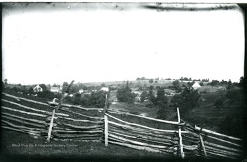
A view of Antietam, Bloody Lane looking south east from the first corner near, likely to be, the Cupp house. 99.D.I.C.
IDNO:
031609
Title:
View of Antietam, Md.
Date:
1884/08/06
Description:
A view of Antietam from Benjamin's battery; the photo was taken about 12:45 p.m. 164 W (68).
IDNO:
031610
Title:
Camp at Old Mill
Date:
1884/07/27
Description:
Photo includes a information sheet that reads 'Taken from under the shed on the extreme right. The long logs are used as ways over in which to roll logs to the saw. At the flume which comes towards us on the right .We washed the dishes. We took our meals on the logs where the bucket is near the horses. Under the shed we spend the day writing journals and letters back home. On the pole are the harnesses covered with the poncho to keep them dry. It rained in torrents the first night we were there and in the midst the horses got scared. They were way off by a fence on the left(that is were, after Fan had been received from the mire hole in which I had fastened her).In the morning we changed them to the horse station of the picture, fastened to an old rig.' 80.D.(49) on back of the photo.
IDNO:
031611
Title:
Pleasant Valley Camp by railroad.
Date:
1884/08/04
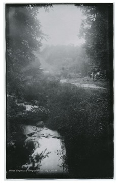
Description:
A small creek meanders through the photo.To the side is a man petting a horse. A buggy is parked by a sign that read 'Look Out for Locomotives.' (80)D.I.C 138 appears on the back of the photo.
IDNO:
031612
Title:
View of Antietam
Date:
1884/08/05
Description:
N.W view of Antietam National Cemetery from Hagerstown Pike. (157 93 D.I.C) included on back.
IDNO:
031613
Title:
Valley of Felled Timber
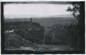
Date:
1884/08/11
Description:
Looking westward towards Fifteen Mile Creek, east of Cumberland, MD. (194 W81) included on back.
IDNO:
031614
Title:
Potomac River and Pleasant Valley from slope of Maryland Heights
Description:
D.81.I.C.140 included on back.
IDNO:
031615
Title:
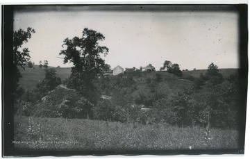
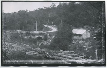
Stone bridge on west side of Negro Mountain
Date:
1884/08/14
Description:
209 122D. on back of photo.
IDNO:
031616
Title:
Old Tavern about nine miles west of Cumberland.
Date:
1884/08/13
Description:
202.W.(86) on back of photo.
IDNO:
031617
Title:
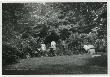
Deakins Family Cemetery
Date:
c.a 1962
Description:
'The Deakins Family Cemetery is unusual in that it is still in current use although surrounded by thousands of suburban Maryland homes.' The name J.C Wilfong Jr. appears on the back of photo.
IDNO:
031618
Title:
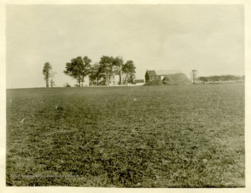
David Miller's Home on North Edge of Antietam
Date:
1884/08/07
Description:
(102.)I.C.173 written on back of photo.
IDNO:
031619
Title:
Massanutten Mountain South End near Old Mill
Date:
1884/07/26
Description:
79D.(46) on back of photo.
IDNO:
031620
Title:
Battle Cedar Creek. Massanutten Mountain
Date:
1884/07/30
Description:
Possibly Three Top Mountain and Thoburn's Camp. 95 W (37) included on the back.
IDNO:
031621
Title:
Cedar Creek Woods held by 6th Corp. according to Rebel gunner of Braxton's battery
Date:
1884/07/30
Description:
100 W 39 B on back of photo.
IDNO:
031622
Title:
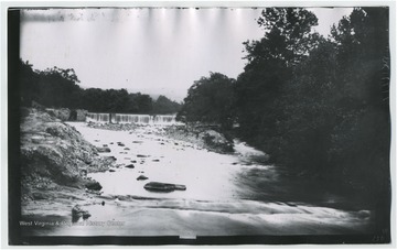
Antietam Falls
Date:
1884/08/05
Description:
150.W.(64) on back of photo.
IDNO:
031623
Title:
Valley beyond Hancock looking back toward Hancock.
Description:
187 W 78 .B on back of photo.
IDNO:
031624
Title:
New Pike Viewed from Old a Few Miles West of Cumberland.
Date:
1884/08/12
Description:
201. D.(117) on back of photo.
IDNO:
031625
Title:
Presbyterian Church in Hagerstown
Date:
1884/08/07
Description:
174 D 103 on back of photo.
IDNO:
031626
Title:
View of the Potamac River and Cumberland Canal
Description:
184 W 77.B. on back of photo.
IDNO:
031629
Title:
Stone Church and Cemetery Eight miles West of Hagerstown, MD
Date:
1884/08/08
Description:
176 104.D on back of photo.
IDNO:
031689
Title:
View of Antietam, Burnsides Stone Bridge, Maryland
Date:
1884/08/06
Description:
A view of Antietam Burnsides stone bridge from the west side looking South East; the photo was taken Wednesday 9:10 am. 94 D. I. C., 155.
IDNO:
031690
Title:
View of Sharpsburg, Maryland
Date:
1884/08/05
Description:
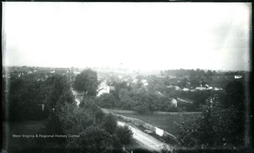
A view of Sharpsburg, the photo was taken Tuesday, 5:55 p.m. from National Cemetery looking West. 92 D.I.C., 156.
IDNO:
031692
Title:
View on Confederate Side Near Burnside Bridge, Maryland
Date:
1884/08/06
Description:
A view on Confederate side near Burnside Bridge; the photo taken at 9:20 am. 159 w65.
IDNO:
031694
Title:
View of Antietam, Dunker Church, Maryland
Date:
1884/08/06
Description:
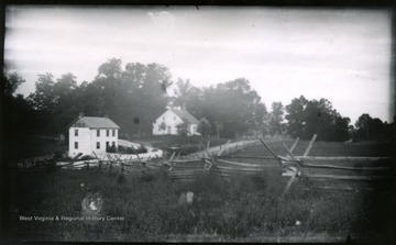
A view of Antietam, Dunker Church looking from south east. The photo was taken on Wednesday at 7:30 pm. 100 D.I.C, 171.
IDNO:
031695
Title:
Dunker Church,, Maryland
Date:
1884/08/06
Description:
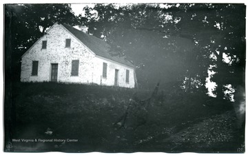
A view of Dunker Church; the photo taken on Wednesday at 7:30 pm; 170.W.71.
IDNO:
031697
Title:
View from Dunker Church, Maryland
Date:
1884/08/06
Description:
A view from Dunker Church looking eastward; the photo taken on Wednesday, 7:45 pm; 172.D.101.
IDNO:
031699
Title:
Tonoloway Creek, Maryland
Date:
1884/08/09
Description:
A view of Tonoloway Creek before Hancock; the photo taken on Saturday at 9:10 am; 186.D.110.
IDNO:
031700
Title:
View of Antietam From Pry House, Washington County, Maryland
Date:
1884/08/06
Description:
A view of Antietam from Pry House, McClellan's headquarters; monuments in cemetery can be seen with magnifier on left horizon; the photo taken on Wednesday at 4:40 pm.
IDNO:
031703
Title:
Eckert's Mine Valley, Maryland
Date:
1884/08/13
Description:
A view of Eckert's Mine Valley from hill west; the photo taken on Wednesday at 10 am; 208.W.87.
IDNO:
031706
Title:
View of Antietam, McClellan's Headquarters from National Cemetery, Maryland
Date:
1884/08/05
Description:
A view of Antietam, McClellan's headquarters from National Cemetery, 2nd view from tower; the photo taken on Friday at 5:35 pm; D.88.I.C.152.
IDNO:
031710
Title:
View of Antietam From Pry House, Washington County, Maryland
Date:
1884/08/06
Description:
A view of Antietam Battlefield from Pry House (McClellan's headquarters) looking between East and West woods; the photograph taken on Wednesday at 4:48 pm; 97.D.I.C.166.
IDNO:
031711
Title:
Antietam, Sinken Creek, Maryland
Date:
1884/08/06
Description:
A view of Antietam, Sinken Creek from Benjamin Battery on Union side of Antietam Creek; the photo taken on Wednesday at 12:45 pm; 96.D.I.C.163.
IDNO:
031714
Title:
Gilpintown Tannery, Maryland
Date:
1884/08/11
Description:
A view of Gilpintown Tannery; the photo taken at 2:40 pm; 196.115.D.
IDNO:
031719
Title:
View of Antietam, Dunker Church, Maryland
Date:
1884/08/06
Description:
The view of Antietam, Dunker Church with East and West Woods from Benjamin Battery; the photo taken on Wednesday at 12:40 pm; 95.D.I.C.162.
IDNO:
031722
Title:
Antietam Cemetery, Maryland
Date:
1884/08/07
Description:
A view of Antietam: South East from National Cemetery towards Burnside Bridge; the photo taken on Tuesday at 5:45 pm; 154.D.90.I.C.
IDNO:
031726
Title:
View of Antietam Soldier's Monument and Cemetery, Maryland
Date:
1884/08/05
Description:
A view of Antietam, Soldiers' Monument taken from Tower of Cemetery, 5th view looking South; the photo taken on Tuesday at 5:50 pm; 155.91.D.I.C.
IDNO:
032936
Title:
Hotel at Mt. Lake Park, Md.
IDNO:
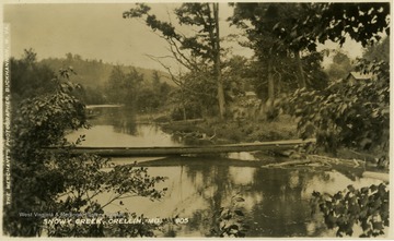
034934
Title:
Snowy Creek, Crellin, MD
IDNO:
038075
Title:
La Grange, Home of the Stonestreet families of Charles Co. Maryland.
IDNO:
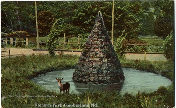
039659
Title:
Narrows Park, Cumberland, Md.
Date:
1912
Description:
Colored postcard photograph. See back of the original image for correspondence.
IDNO:
041271
Title:
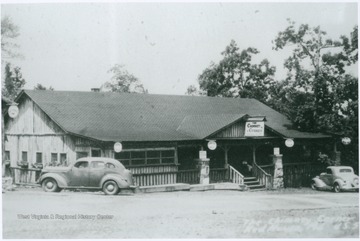
Chimney Corners, Red House, Md.
Description:
Just outside of Preston Co., W. Va. on Route 50.
IDNO:
042254
Title:
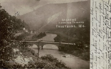
Narrows Between Haystack and Wills Mountains Looking Toward Frostburg, Md.
Description:
An elevated view of probably the National Highway Bridge crossing Wills Creek in the Narrows.
IDNO:
043075
Title:
B. & O. Depot, Mountain Lake Park, Garrett Co., Md.
Date:
ca. 1906
Description:
See original for correspondence.
IDNO:
043076
Title:
B. & O. Railroad Depot, Oakland, Garrett County, Md.
Date:
ca. 1906
Description:
See original for correspondence.
IDNO:
043079
Title:
Yough River, 2 Miles from Oakland, Garrett County, M.
Date:
ca. 1908
Description:
Youghiogeny River flows through Garrett County in Maryland and feeds into the Monongahela River.
IDNO:
043082
Title:
Red News Hall, Brunswick, Frederick County, Md.
Date:
ca. 1907
Description:
Published by Elgin & Brady. See original for correspondence.
IDNO:
044457
Title:
John Brown's Weapons at Harpers Ferry, and Cabin Armories Near Sharpsburg, MD.
Date:
ca. 1908
Description:
Published by W. L. Erwin. (From postcard collection legacy system--subject.)
IDNO:
044470
Title:
John Brown's Residence, Kennedy Farm in Maryland Heights, Just Before Raid at Harpers Ferry in 1859
Date:
1908
Description:
Published by W. L. Erwin. (From postcard collection legacy system--subject.)
IDNO:
044734
Title:
Westernport High School, Westernport, MD
Date:
ca. 1906
IDNO:
044901
Title:
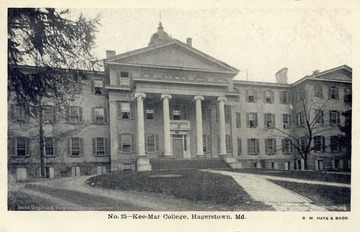
Kee Mar College, Hagerstown, Md.
Description:
Published by R.M. Hays and Brothers. (From postcard collection legacy system--Non-WV.)
IDNO:
044902
Title:
Court House, Cumberland, Md.
Date:
ca. 1910
Description:
See original for correspondence. Published by K-win and Company. (From postcard collection legacy system--Non-WV.)
IDNO:
044903
Title:
Cumberland Valley and Norfolk and Western Railroad Station, Hagerstown, Md.
Date:
ca. 1908
Description:
Published by R.M. Hays Brothers. (From postcard collection legacy system--Non-WV.)
IDNO:
044904
Title:
St. John's Episcopal Church, Frostburg, Md.
Date:
ca. 1931
Description:
See original for correspondence. Published by The Neff Novelty Company. (From postcard collection legacy system--Non-WV.)
IDNO:
044906
Title:
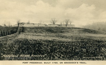
Fort Frederick on Braddock's Trail, Md.
Description:
Fort was built in 1775. Published by The Albertype Company. (From postcard collection legacy system--Non-WV.)
IDNO:
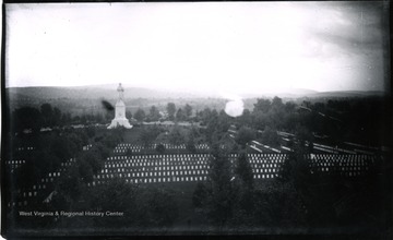
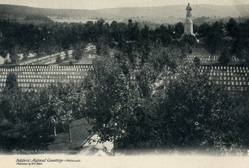
044907
Title:
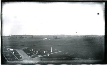
Soldiers National Cemetery at Antietam, Sharpsburg, Md.
Description:
Published by W.H. Tipton. (From postcard collection legacy system--Non-WV.)
IDNO:
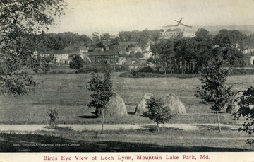
044908
Title:
Birds Eye View of Loch Lynn, Mountain Lake Park, Md.
Date:
ca. 1912
Description:
(From postcard collection legacy system--Non-WV.)
IDNO:
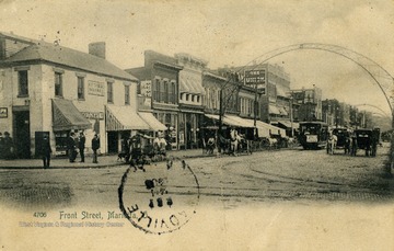
044910
Title:
Front Street, Marietta, OH.
Date:
ca. 1915
Description:
Published by The Rotograph Company. (From postcard collection legacy system--Non-WV.)
IDNO:
047933
Title:
Suitcase Belonging to Newly Married Couple at Baltimore and Ohio Railroad Station, Oakland, Md.
Date:
Undated
IDNO:
048023
Title:
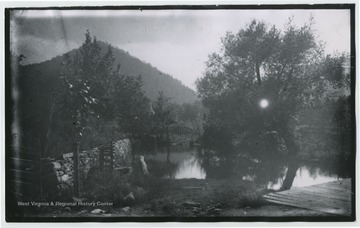
Drive Way From Crystal Spring, Mt. Lake Park, Md.
Date:
Undated
Description:
Appears to be some sort of mill or factory across body of water.
IDNO:
048025
Title:
Baltimore and Ohio Railroad Station, Mt. Lake Park, Md.
Date:
Undated
IDNO:
051592
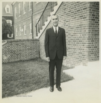
Title:
Harold H. Miller Outside of Cecil Hall, University of Maryland, College Park, Md.
Date:
1960/06
Description:
Miller was a life-long school teacher who taught in the Maryland towns of Oakland and Elkton, as well as Terra Alta High School in Preston County, W. Va. He served in both World War II and the Korean War.
IDNO:
051593
Title:
Harold Miller and Associates Outside of Cecil Hall, University of Maryland, College Park, Md.
Date:
1959
Description:
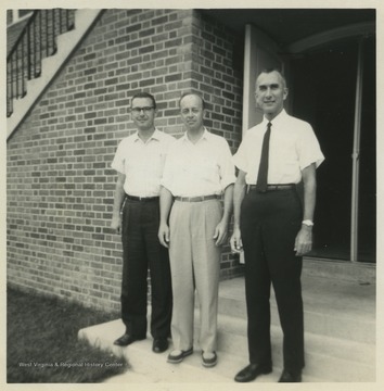
Leonard Warren of Los Angelos, Ca. (left), Captain John Lunger of Williamsburg, Va. (center) and Harold Miller (right) are pictured outside of the university building. Miller was a life-long school teacher at Terra Alta High School. He served in both World War II and the Korean War.
IDNO:
051647
Title:
Bernie DeBerry, Oakland, Md.
Date:
ca. 1960
Description:
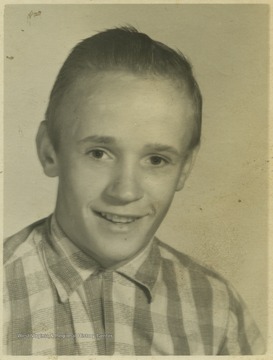
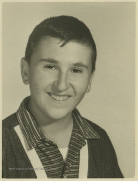
DeBerry, a student at Southern Garrett High School, poses for his school portrait.
IDNO:
051676
Title:
Gary Davis, Oakland, Md.
Date:
ca. 1960
Description:
Davis, a student at Southern Garrett High School, poses for his school photo.
IDNO:
051677
Title:
Billy Mousck, Oakland, Md.
Date:
ca. 1960
Description:
Mousck, a student at Southern Garrett High School, poses for his school photo.
IDNO:
051678
Title:
Clark Sharpless, Oakland, Md.
Date:
ca. 1960
Description:
Sharpless, a student at Southern Garrett High School, poses for his school photo.
IDNO:
051679
Title:
Tom Forman, Oakland, Md.
Date:
ca. 1960
Description:
Forman, a student at Southern Garrett High School, poses for his school photo.
IDNO:
051680
Title:
Harold Upole, Oakland, Md.
Date:
ca. 1960
Description:
Upole, a student at Southern Garret High School, poses for his school photo.
