Search Results
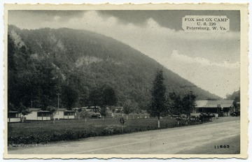
- IDNO:
- 053696
- Title:
- Fox and Ox Camp, Petersburg Gap, W. Va.
- Date:
- undated
- Description:
- Fox and Ox Camp viewed from U. S. Route 220.
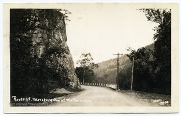
- IDNO:
- 053698
- Title:
- Route 28 at Petersburg Gap, W. Va.
- Date:
- undated
- Description:
- Petersburg Gap is the location of Picture Rocks, a rock formation that resembles a fox and an ox.
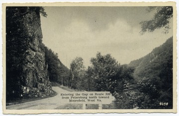
- IDNO:
- 053699
- Title:
- Petersburg Gap, W. Va.
- Date:
- undated
- Description:
- Text reads, "Entering the Gap on Route 220 from Petersburg north toward Moorefield, W. Va."

- IDNO:
- 053700
- Title:
- On Route 220 at Petersburg Gap, W. Va.
- Date:
- undated

- IDNO:
- 053701
- Title:
- On Route 28, Road Through Petersburg Gap, W. Va.
- Date:
- undated

- IDNO:
- 053702
- Title:
- Route 28, Road Along South Branch Potomac River, Petersburg Gap, W. Va.
- Date:
- undated

- IDNO:
- 053703
- Title:
- Route 28, Petersburg Gap, Petersburg, W. Va.
- Date:
- undated
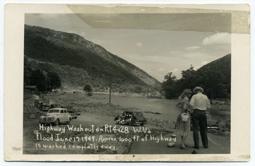
- IDNO:
- 053718
- Title:
- Highway Washout on Routes 4 and 28, Petersburg, W. Va.
- Date:
- 1949/06/17
- Description:
- Text reads, "Highway washout on Rts. 4 and 28, W. Va. Flood June 17 2019. Approx. 1000 ft. of highway is washed completely away."

- IDNO:
- 053759
- Title:
- Maysville Gap, near Petersburg, W. Va.
- Date:
- undated

- IDNO:
- 053760
- Title:
- U. S. 220 near Petersburg, W. Va.
- Date:
- ca. 1943

- IDNO:
- 053761
- Title:
- Horseshoe Curve on Scherr Mountain, Grant County, W. Va.
- Date:
- undated
- Description:
- Greenland Gap in the middle distance.

- IDNO:
- 053762
- Title:
- U. S. 33 Between Mouth of Seneca and Harman, W. Va.
- Date:
- undated

- IDNO:
- 053763
- Title:
- Big Curve between Harman and Onego, W. Va.
- Date:
- undated
- IDNO:
- 053764
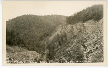
- Title:
- Route 5 between Harman and Onego, W. Va.
- Date:
- undated
- Description:
- The caption reads, "Route 5, Harman - Onego, 9% grade 3 miles from 1800 - 3300 alt."
- IDNO:
- 053765
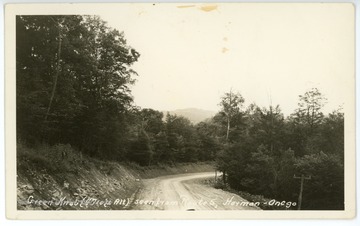
- Title:
- Green Knob seen from Route 5, Harman - Onego, W. Va.
- Date:
- undated
- Description:
- Green Knob altitude is 4710 ft.

- IDNO:
- 053766
- Title:
- Hanging Rocks, near Cabins, W. Va.
- Date:
- undated

- IDNO:
- 053767
- Title:
- Wildcat Rock, W. Va.
- Date:
- undated
- IDNO:
- 053768
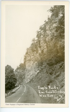
- Title:
- Eagle Rocks, near Petersburg, W. Va.
- Date:
- undated
- Description:
- Eagle Rocks is located 1/4 mile from Petersburg, W. Va., on Route 28.
- IDNO:
- 053771
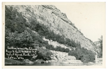
- Title:
- Hyres Rocks, Cabins, W. Va.
- Date:
- ca. 1949
- Description:
- Text reads, "Looking across the Potomac River to Routes 4 and 28 at the foot of Hyres Rocks, Cabins, W. Va."

- IDNO:
- 053780
- Title:
- Wildcat Rock at Smoke Hole Cavern, near Petersburg, W. Va.
- Date:
- undated
- Description:
- Wildcat Rock is located on Routes 4 and 28.