Search Results
IDNO:
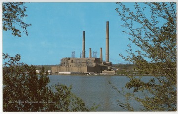
053665
Title:
Virginia Electric and Power Company, Near Davis, W. Va.
Date:
ca. 1965
Description:
Text on back reads, "The new multi-million dollar electric power plant on W. Va. Route 93, between Mt. Storm on Route 50 and Blackwater Falls at Davis, W. Va. This plant, built on Stony River, also affords a lake for boating and fishing."
IDNO:
053666
Title:
Virginia Electric and Power Company, Mt. Storm, W. Va.
Date:
undated
Description:
Text on back reads, "West Virginia Energy Center, Mt. Storm Power Station, Star Route Box 430, Mt. Storm, WV 26739. The Mount Storm Power Station is located on Mt. Storm Lake in the rugged Allegheny Mountains of north-eastern West Virginia. The 1,200-acre lake, built to serve the power station, also serves as a public recreation center. The station is known as a "mine-mouth" plant and is the largest coal-fired power station owned and operated by Virginia Power."
IDNO:
053667
Title:
Stony River Dam, Mt. Storm, W. Va.
Date:
undated
Description:
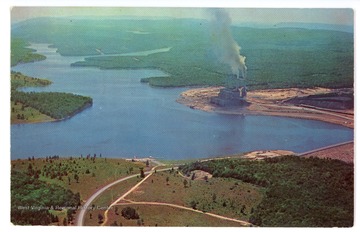
Text on the back reads, "Stony River Dam and $150,000,000 power plant of the Virginia Electric and Power Company near Mt. Storm, West Virginia. This new 1200 acre lake is located in some of the most rugged country in West Virginia. In the distance is the old Stony River Dam. The highway shown is W. Va. Route 93 which crosses the dam and follows Beaver Creek to Davis, West Virginia. This area is approximately 25 miles from Oakland."
IDNO:
053668
Title:
Cottage at Jackson's Mill, Lewis County, W. Va.
Date:
undated
IDNO:
053669
Title:
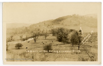
A Glimpse of the Valley at Luney's Creek, W. Va.
Description:
Luney's Creek is located near the town of Petersburg in Grant County, W. Va.
IDNO:
053670
Title:
The Rock House, Near Petersburg, W. Va.
Date:
ca. 1906
IDNO:
053671
Title:
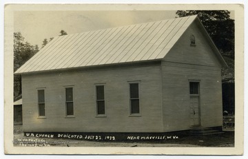
United Brethren Church, Near Maysville, W. Va.
Date:
ca. 1928
Description:
The church was dedicated July 22, 1923.
IDNO:
053672
Title:
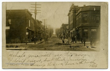
Main Street, Hundred, W. Va.
Date:
undated
IDNO:
053673
Title:
Main Street, Keyser, W. Va.
Date:
ca. 1907
IDNO:
053674
Title:
High School Buildings, Keyser, W. Va.
Date:
ca. 1907
IDNO:
053675
Title:
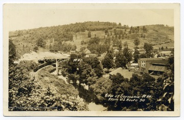
Gormania, W. Va.
Date:
undated
Description:
A view of Gormania, W. Va. from U. S. Route 50 showing parts of the town.
IDNO:
053676
Title:
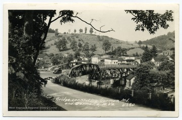
Bridge Connecting Gorman, M. D. to Gormania, W. Va.
Date:
undated
Description:
The bridge spans the North Branch Potomac River.
IDNO:
053677
Title:
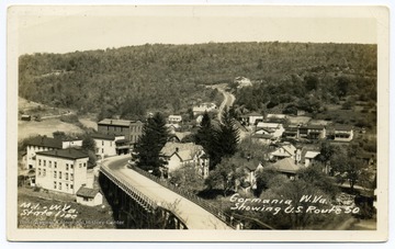
Gormania, W. Va.
Date:
undated
Description:
A view of Gormania from U. S. Route 50.
IDNO:
053678
Title:
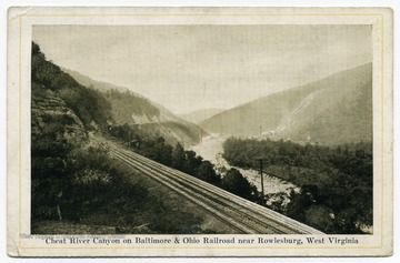
Cheat River Canyon on Baltimore and Ohio Railroad, Near Rowlesburg, W. Va.
Date:
undated
IDNO:
053679
Title:
Piedmont, W. Va.
Date:
undated
IDNO:
053680
Title:
Bloomington Bridge, Near Piedmont, W. Va.
Date:
ca. 1907
Description:
The Bloomington Bridge, finished around 1842, was part of the Baltimore and Ohio Railroad's route past Piedmont, W. Va. The bridge crosses the North Branch Potomac River.
IDNO:
053681
Title:
The Quiet Country Home, Horton, W. Va.
Date:
undated
IDNO:
053682
Title:
Pickens, W. Va.
Date:
ca. 1907
IDNO:
053683
Title:
A View of Parsons, W. Va.
Date:
ca. 1922
Description:
A view of Parsons, W. Va., looking west.
IDNO:
053684
Title:
Philippi Blanket Mill
Date:
undated
IDNO:
053685
Title:
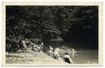
The Swimming Area, Camp Horseshoe, Parsons, W. Va.
Date:
ca. 1942
Description:
Camp Horseshoe was a West Virginia State Y. M. C. A. camp.
IDNO:
053686
Title:
Pulp and Paper Mill, Parsons, W. Va.
Date:
undated
IDNO:
053687
Title:
Seneca Trail, View of Corrick's Ford Battle Field, Near Parsons, W. Va.
Date:
1861
IDNO:
053688
Title:
Y. M. C. A. Camp Horseshoe, Parsons, W. Va.
Date:
undated
IDNO:
053689
Title:
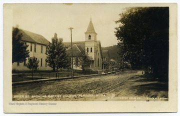
River Street, Parsons, W. Va.
Date:
undated
Description:
Visible along the street is the Baptist Church.
IDNO:
053690
Title:
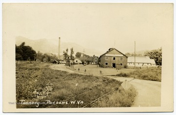
Tannery, W. Va.
Date:
undated
IDNO:
053691
Title:
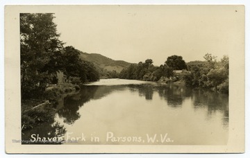
Shaver Fork, Parsons, W. Va.
Date:
ca. 1948
Description:
Shavers Fork is the confluence of the Cheat River and Black Fork in Parsons, W. Va.
IDNO:
053692
Title:
Parsons, W. Va.
Date:
ca. 1951
IDNO:
053693
Title:
Fox and Ox Camp, Petersburg Gap, W. Va.
Date:
undated
IDNO:
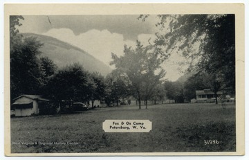
053694
Title:
Fox and Ox Camp, Petersburg, W. Va.
Date:
undated
Description:
Text on the back reads, "Fox and Ox Camp. Good fishing - swimming - home cooking. On U. S. 220, 2 miles north of Petersburg, W. Va."
IDNO:
053695
Title:
Fox and Ox Camp, Petersburg Gap, W. Va.
Date:
ca. 1930
IDNO:
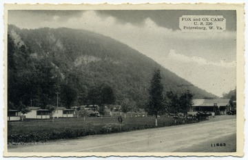
053696
Title:
Fox and Ox Camp, Petersburg Gap, W. Va.
Date:
undated
Description:
Fox and Ox Camp viewed from U. S. Route 220.
IDNO:
053697
Title:
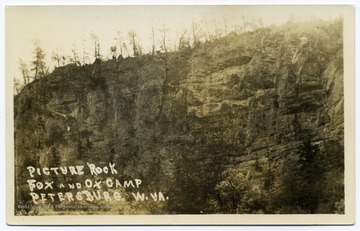
Picture Rock, Fox and Ox Camp, Petersburg, W. Va.
Date:
undated
Description:
Rock formations on this cliff face resemble a fox and an ox, thus giving the camp its name.
IDNO:
053698
Title:
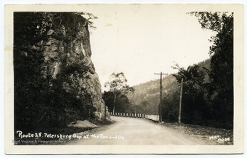
Route 28 at Petersburg Gap, W. Va.
Date:
undated
Description:
Petersburg Gap is the location of Picture Rocks, a rock formation that resembles a fox and an ox.
IDNO:
053699
Title:
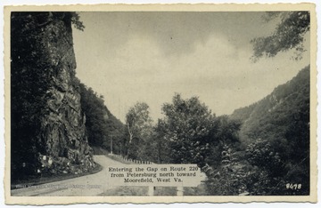
Petersburg Gap, W. Va.
Date:
undated
Description:
Text reads, "Entering the Gap on Route 220 from Petersburg north toward Moorefield, W. Va."
IDNO:
053700
Title:
On Route 220 at Petersburg Gap, W. Va.
Date:
undated
IDNO:
053701
Title:
On Route 28, Road Through Petersburg Gap, W. Va.
Date:
undated
IDNO:
053702
Title:
Route 28, Road Along South Branch Potomac River, Petersburg Gap, W. Va.
Date:
undated
IDNO:
053703
Title:
Route 28, Petersburg Gap, Petersburg, W. Va.
Date:
undated
IDNO:
053704
Title:
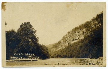
High Rocks, Petersburg Gap, W. Va.
Description:
The South Branch of the Potomac River flows through Petersburg Gap, W. Va.
IDNO:
053705
Title:
Picture Rocks, Fox and Ox Camp, Petersburg Gap, Petersburg, W. Va.
Date:
ca. 1950
IDNO:
053706
Title:
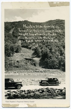
Mountain Slide, Petersburg, W. Va.
Date:
1949/06/17
Description:
Text reads, "Mountain Slide, approx. 2 1/2 mi. Torrential rains on June 17 1949 brought tons of earth and rock from mountain side blocking routes 4 and 28. Petersburg, W. Va."
IDNO:
053707
Title:
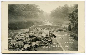
Lunice Creek Bridge in Flood, Petersburg, W. Va.
Date:
1949/06/17
Description:
Text reads, "Scene on Route 42 between Maysville and Petersburg, W. Va. Lunice Creek Bridge, Petersburg, Flood June 17 1949."
IDNO:
053708
Title:
Flooded Streets, Petersburg, W. Va.
Date:
1924
IDNO:
053709
Title:
Mountain Slides on Routes 4 and 28, Petersburg, W. Va.
Date:
1949/06/17
IDNO:
053710
Title:
Wreckage of Flood, South End of Petersburg, W. Va.
Date:
1949/06/17
IDNO:
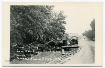
053711
Title:
Wreckage of Flood, Petersburg, W. Va.
Date:
1949/06/17
Description:
Text reads, "Scene of wreckage after Petersburg, W. Va. flood June 17 1949. Scene back of Tanners, Petersburg, W. Va."
IDNO:
053712
Title:
Wreckage on Johnson Run, South Petersburg, W. Va.
Date:
1949/06/17

