Search Results
- IDNO:
- 031104
- Title:
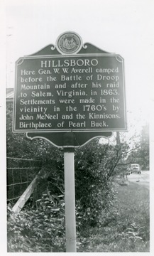
- Hillsboro Historic Marker
- Date:
- 1952
- Description:
- Hillsboro marker below Marlinton on U.S Route 219. 'Hillsboro, Here Gen. W. W. Averell camped before the Battle of Droop Mountain after his raid to Salem, Virginia in 1863. Settlements were made in the vicinity in the 1760s by John McNeel and the Kinnisons. Birthplace of Pearl Buck.'

- IDNO:
- 031119
- Title:
- Boy Standing Next to the Fort Paw Paw Marker

- IDNO:
- 031120
- Title:
- Garard's Fort Marker
- IDNO:
- 031121
- Title:
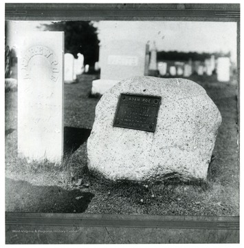
- Adam Poe Grave Marker
- IDNO:
- 031122
- Title:
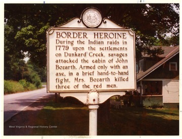
- Border Heroine Marker

- IDNO:
- 031123
- Title:
- McCulloch's Path Marker Between Terra Alta, W. Va. and Oakland, Md. on State Route 7
- Date:
- 1955

- IDNO:
- 031124
- Title:
- Williamson Marker on U.S. 119 in Mingo County, W. Va.
- Date:
- 1951

- IDNO:
- 031125
- Title:
- Cranberry Glades Marker at Mill Point, Pocahontas County, W. Va.
- Date:
- 1952

- IDNO:
- 031126
- Title:
- Morgantown Marker on Court House Square, Morgantown, W. Va.
- Date:
- 1951

- IDNO:
- 031127
- Title:
- Charles Friend's Home Marker on State Route 7 Between Terra Alta, W. Va. and Oakland, Md.
- Date:
- 1955
- IDNO:
- 031128
- Title:
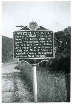
- Wetzel County Marker on State Route 2 Between Wheeling and New Martinsville, W. Va.
- Date:
- 1956/06
- IDNO:
- 031305
- Title:
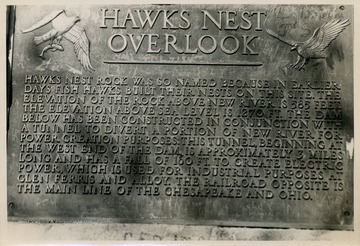
- Hawks Nest Overlook Marker
- Date:
- 1949
- Description:
- 'Hawks Nest Rock was so named because in earlier days fish hawks built their nets on this site. The elevation of the rock above New River is 585 feet. The elevation above sea level is 1270 ft. The Dam below has been constructed in conjunction with a tunnel to divert a portion of New River for power creation purposes. This tunnel beginning at the west end of the dam is approximately 3 miles long and has a fall of 160 ft. to create electric power, which is used for industrial purposes at Glen ferris and Alloy. The railroad opposite is the main line of the Chesapeake and Ohio.'


