Search Constraints
« Previous |
1 - 24 of 156
|
Next »
Search Results
IDNO:
020043
Title:
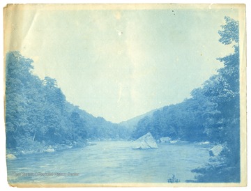
Possibly Quarry Run, Monongalia County, W. Va.
Date:
undated
IDNO:
050319
Title:
Rural Scene at Buzzard's Rock Overlooking the Cheat River, Monongalia County, W. Va.
Date:
undated
Description:
Two boys are pictured on top of the rock, looking east. Subjects unidentified.
IDNO:
050321
Title:
Scene at Squirrel Rock on Cheat River, Monongalia County, W. Va.
Date:
undated
Description:
Four men sit in a canoe beside the large boulder in the middle of the river. Subjects unidentified.
IDNO:
052933
Title:
On Cheat River, W. Va.
Date:
undated
Description:
A group of young men and women pose on a rocky hillside near the Cheat River, W. Va.
IDNO:
053003
Title:
Devil's Den, Cheat River, W. Va.
Date:
undated
Description:
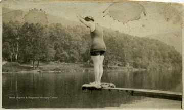
The Devil's Den is a swimming hole located on the Cheat River near the mouth of the Big Sandy.
IDNO:
053418
Title:
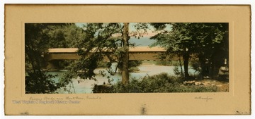
Covered Bridge Over Cheat River, Route 50, W. Va.
Date:
undated
Description:
Text on back reads, "Caption 'Actual photograph, hand painted with finest (?) oils' on original frame."
IDNO:
034532
Title:
Rockley on Cheat River, Monongalia County, W. Va.
Date:
ca.1910
IDNO:
017284
Title:
Cheat River From Mont Chateau, Morgantown, W. Va.
Date:
ca. 1960
IDNO:
016277
Title:
Couple Enjoying the View at Coopers Rock, Monongalia County, W. Va.
Date:
ca. 1960
Description:
'See the spectacular Cheat River Canyon from the overlook at Coopers Rock State Forest, near Morgantown.
IDNO:
016840
Title:
Young Couple Enjoying the View from the Overlook at Cooper's Rock State Park, Monongalia County, W. Va.
Date:
ca. 1950
Description:
Photo by Conservation Commission of West Virginia.
IDNO:
034491
Title:
Pedestrian Bridge in Monongalia County, W. Va.
Date:
ca. 1938-1969
IDNO:
039130
Title:
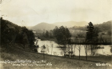
Corricks Ford Battlefield and Seneca Trail on Cheat River, Parsons, Tucker County, W. Va.
Date:
ca. 1934
Description:
Photograph postcard of Corricks Ford on the Cheat River where Union forces commanded by General Thomas Morris, defeated Confederate troops under General Robert Garnett, July 13,1861. Garnett was killed in the fight, the first general officer to die in action in the Civil War.
IDNO:
020200
Title:
Cheat River
Date:
ca. 1930
IDNO:
020201
Title:
Cheat River
Date:
ca. 1926-1936
IDNO:
020204
Title:
Cheat River
Date:
ca. 1926-1936
IDNO:
020203
Title:
Cheat River
Date:
ca. 1926-1936
IDNO:
020206
Title:
Scenic View of the Cheat River
Date:
ca. 1926-1936
IDNO:
053082
Title:
Cheat River, Monongalia County, W. Va.
Date:
ca. 1920
IDNO:
053087
Title:
Boating on the Cheat River, Near Morgantown, W. Va.
Date:
ca. 1920
Description:
A group of men pend time in boats on the Cheat River. The banner in the background reads in part, "Elkhorn Hunting."
IDNO:
053081
Title:
Squirrel Rock, Cheat River, Near Morgantown, W. Va.
Date:
ca. 1920
Description:
A man in a rowboat pauses by Squirrel Rock, which was submerged with the construction of the Cheat Lake Dam in 1926.
IDNO:
053084
Title:
Cheat River, Monongalia County, W. Va.
Date:
ca. 1920
IDNO:
053090
Title:
Squirrel Rock, Cheat River, Near Morgantown, W. Va.
Date:
ca. 1920
Description:
A view of Squirrel Rock, which was submerged when the Cheat Lake Dam was opened in 1926.
IDNO:
053091
Title:
Rowboat on the Cheat River, Near Morgantown, W. Va.
Date:
ca. 1920
IDNO:
053079
Title:
Squirrel Rock, Cheat River, Near Morgantown, W. Va.
Date:
ca. 1920
Description:
Squirrel Rock was submerged when the Cheat Lake Dam was completed in 1926.


