Search Results

- IDNO:
- 005583
- Title:
- Bridge Across the Kanawha River at Charleston, W. Va.
- Date:
- ca. 1900

- IDNO:
- 005584
- Title:
- Charleston, W. Va.
- Date:
- ca. 1900
- Description:
- Many telephone wires stretch along a street in downtown, Charleston, W. Va.

- IDNO:
- 005585
- Title:
- Aerial View of C. and C. C. C., South Charleston, W. Va.
- Date:
- ca. 1940

- IDNO:
- 005586
- Title:
- Memorial Plaque for G. B. Capito, M.D., Charleston, W. Va.
- Date:
- 1960-1964
- Description:
- Two men unveil a plaque dedicated to G. B. Capito of Charleston.
- IDNO:
- 005587
- Title:
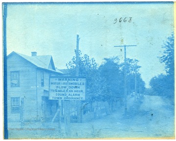
- Automobile Warning Sign in Charleston, W. Va.
- Date:
- 1911
- Description:
- Sign warning automobiles to slow down.

- IDNO:
- 005588
- Title:
- Elk River Bridge Disaster, Charleston, W. Va.
- Date:
- 1904
- Description:
- Crowds gather along the banks of the Elk River while people walk out on the fallen bridge to rescue people in the water.
- IDNO:
- 005589
- Title:
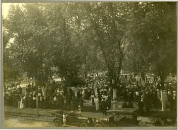
- Political Rally, Charleston, W. Va.
- Date:
- ca. 1915
- Description:
- Large group of people gather together under trees in Charleston, W. Va. Location is possibly the old state capitol grounds.
- IDNO:
- 005590
- Title:
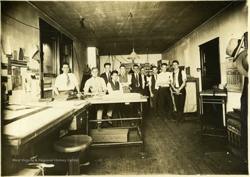
- Employees of an Unidentified Shop in Charleston, W. Va.
- IDNO:
- 005591
- Title:
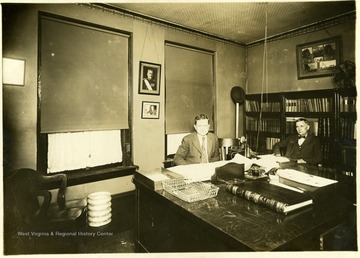
- Unidentified Lawyers, Charleston, W. Va.
- IDNO:
- 013275
- Title:
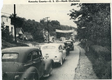
- Traffic on U. S. 35, North Charleston, Kanawha County, W. Va.
- IDNO:
- 013276
- Title:
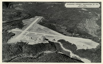
- Aerial View of Kanawha Airport, Charleston, W. Va.
- Date:
- ca. 1952
- Description:
- 'Kanawha Airport, Charleston, W. Va., Elevation 985 feet, Class 4; Northeast-Southwest Runway 5200 feet. Northwest-Southeast Runway 4750 feet; More than 9,100,000 cubic yards rock and earth moved in its construction. Four and one half miles highway distance from downtown Charleston.'
- IDNO:
- 013277
- Title:
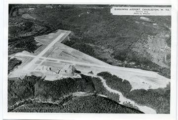
- Aerial View of Kanawha Airport, Charleston, W. Va.
- Date:
- 1952
- Description:
- 'Kanawha Airport, Charleston, W. Va., Elevation 985 feet, Class 4; Northeast-Southwest Runway 5200 feet. Northwest-Southeast Runway 4750 feet; More than 9,100,000 cubic yards rock and earth moved in its construction. Four and one half miles highway distance from downtown Charleston.'


