Search Results
- IDNO:
- 026513
- Title:
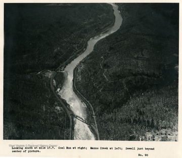
- New River Near Sewell, West Virginia
- Date:
- 1932
- Description:
- 'Looking south at mile 17.7. Coal Run at right; Manns Creek at left; Sewell just beyond center of picture.'
- IDNO:
- 026514
- Title:
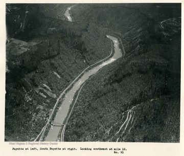
- New River Near Fayette, West Virginia
- Date:
- 1932
- Description:
- 'Fayette at left. South Fayette at right. Looking southeast at mile 12.'
- IDNO:
- 026515
- Title:
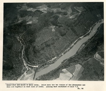
- New River Near Hawks Nest, West Virginia
- Date:
- 1932
- Description:
- 'Hawks Nest and mouth of Mill Creek. Below here the two tracks of the Chesapeake and Ohio are together on west side of river. Looking east southeast at mile 7.4.'
- IDNO:
- 026518
- Title:
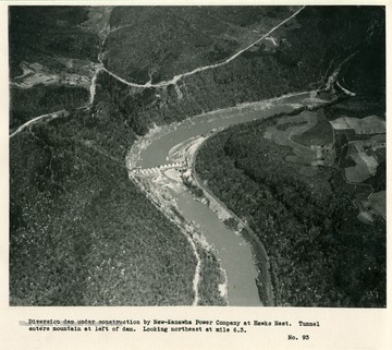
- New River Near Hawks Nest, West Virginia
- Date:
- 1932
- Description:
- 'Diversion dam under construction by New Kanawha Power Company at Hawks Nest. Tunnel enters mountain at left of dam. Looking northeast at mile 6.3.'

- IDNO:
- 026523
- Title:
- New River Near Cotton Hill, West Virginia
- Date:
- 1932
- Description:
- 'Looking southeast at mile 5.4. Bridge at Cotton Hill on U.W. Highway No.19, Highway extends down Laurel Creek from west (left) follows down New River canyon for about two miles, then turns east.'
- IDNO:
- 026524
- Title:
- New River Near Hawks Nest, West Virginia
- Date:
- 1932
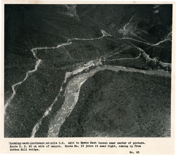
- Description:
- 'Looking east northeast at mile 3.2. Adit to Hawks Nest tunnel near center of picture. Route U.S. 60 on side of canyon. Route No. 19 joins it near right, coming up from Cotton Hill bridge.'
- IDNO:
- 026527
- Title:
- New River Near Hawks Nest, West Virginia
- Date:
- 1932
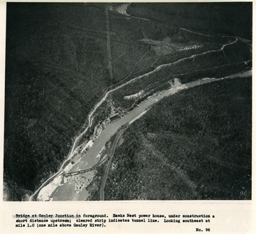
- Description:
- 'Bridge at Gauley Junction in foreground. Hawks Nest power house, under construction a short distance upstream; cleared strip indicates tunnel line. Looking southeast at mile 1.0 (one mile above Gauley River).'
- IDNO:
- 026529
- Title:
- Kanawha River Near Handley, West Virginia
- Date:
- 1932
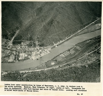
- Description:
- 'London Lock under construction by Corps of Engineers, U.S. Army, to replace Lock 2, two miles upstream. Handley, West Virginia, at right, London at left. Chesapeake and Ohio in foreground. New York Central and route 60 beyond river. Looking east southeast 14 miles below mouth of Gauley River.'

- IDNO:
- 026530
- Title:
- New River Near Marmet, West Virginia
- Date:
- 1932/04/28
- Description:
- 'Marmet Lock under construction by U.S. Engineers, just above Lock 5 which it is designed to replace. Marmet, West Virginia, in foreground. Platt cross Kanawha River. Looking east northeast 28 miles below mouth of Gauley River. Taken about 1:30 p.m., April 28, 1932.'
- IDNO:
- 026531
- Title:
- New River Near Gauley, West V irginia
- Date:
- 1932
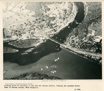
- Description:
- 'Looking north at junction of the New and Gauley Rivers, forming the Kanawha River. Town of Gauley Bridge, West Virginia.'
- IDNO:
- 026532
- Title:
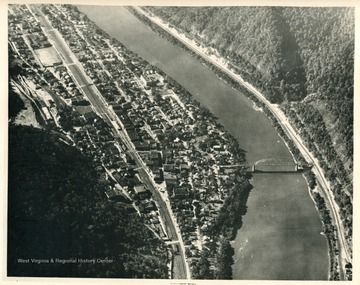
- Montgomery, West Virginia
- Date:
- 1932
- Description:
- 'Looking downstream west northwest at mile 10.7. Montgomery, West Virginia.'
- IDNO:
- 026533
- Title:
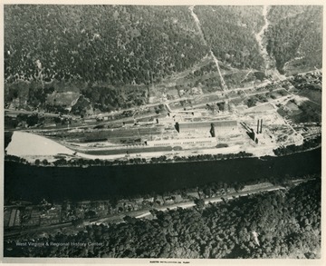
- Alloy, West Virginia
- Date:
- 1932
- Description:
- 'Plant of Electro Metallurigical Company at Alloy, West Virginia, seven miles below Gauley River.'


